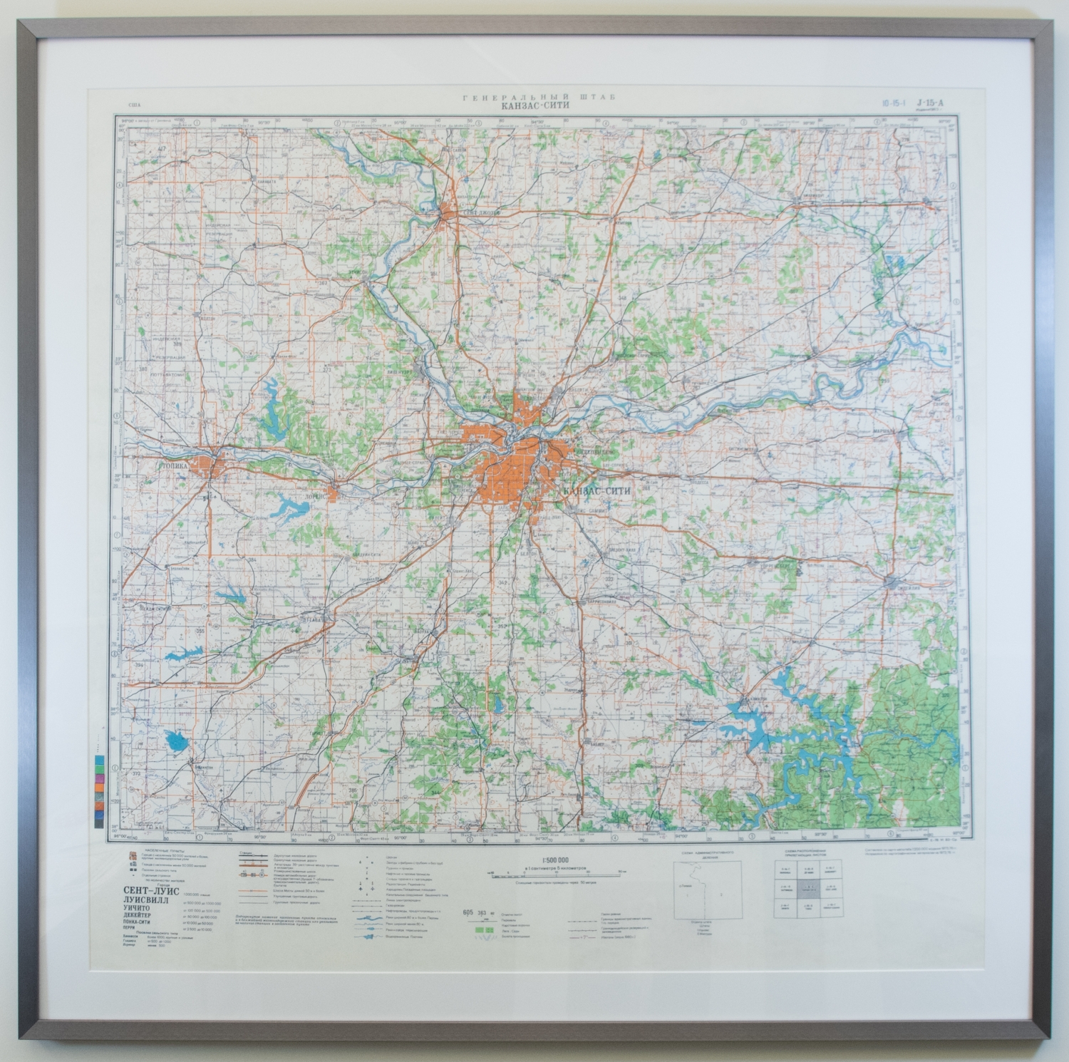
Russian Map of Kansas City
This enlarged map of Kansas City with a scale of 1:500,000 (1 centimeter to 5 kilometers) including a regional breadth of about 150 miles in any direction. The map is in Russian and focuses on infrastructural features in the region including road and railways, oil, gas, and airfields, gas and power lines, and dams and reservoirs amongst other things. The map's title translates roughly to the General Area of Kansas City and had 10-15-I J-15-A Edition 1983 stamped in the upper right-hand corner. A number of legends span the bottom edge of the map including one for cities and their populations, the infrastructural features mentioned above, land features, state and Indian Reservation boundaries, as well as this particular map's placement in relation to other versions of surrounding regions.