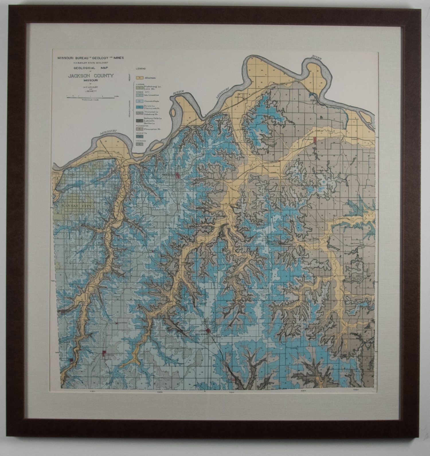
Missouri Bureau of Geology and Mines Map of Jackson County, Mo
This map color codes the geological mines throughout Jackson County with an accompanying legend. The legend includes the following mineral deposits: Alluvium, Iola Limestone, Chanute Shale, Drum LS, Cherryvale Sh, Winterset LS, Galesburg Sh, Bethany Falls LS, Ladore Sh, Hertha LS, Pleasanton Sh. The following areas are noted for each mineral: Lansing, Kansas City, Pleasanton, Henrietta, and Cherokee. The cartographic authors are noted as W.E. McCourt and J. Bennett, and other text further indicates H. A. Buehler as the State Geologist.