A Bird's Eye View of Wyandotte (Small)
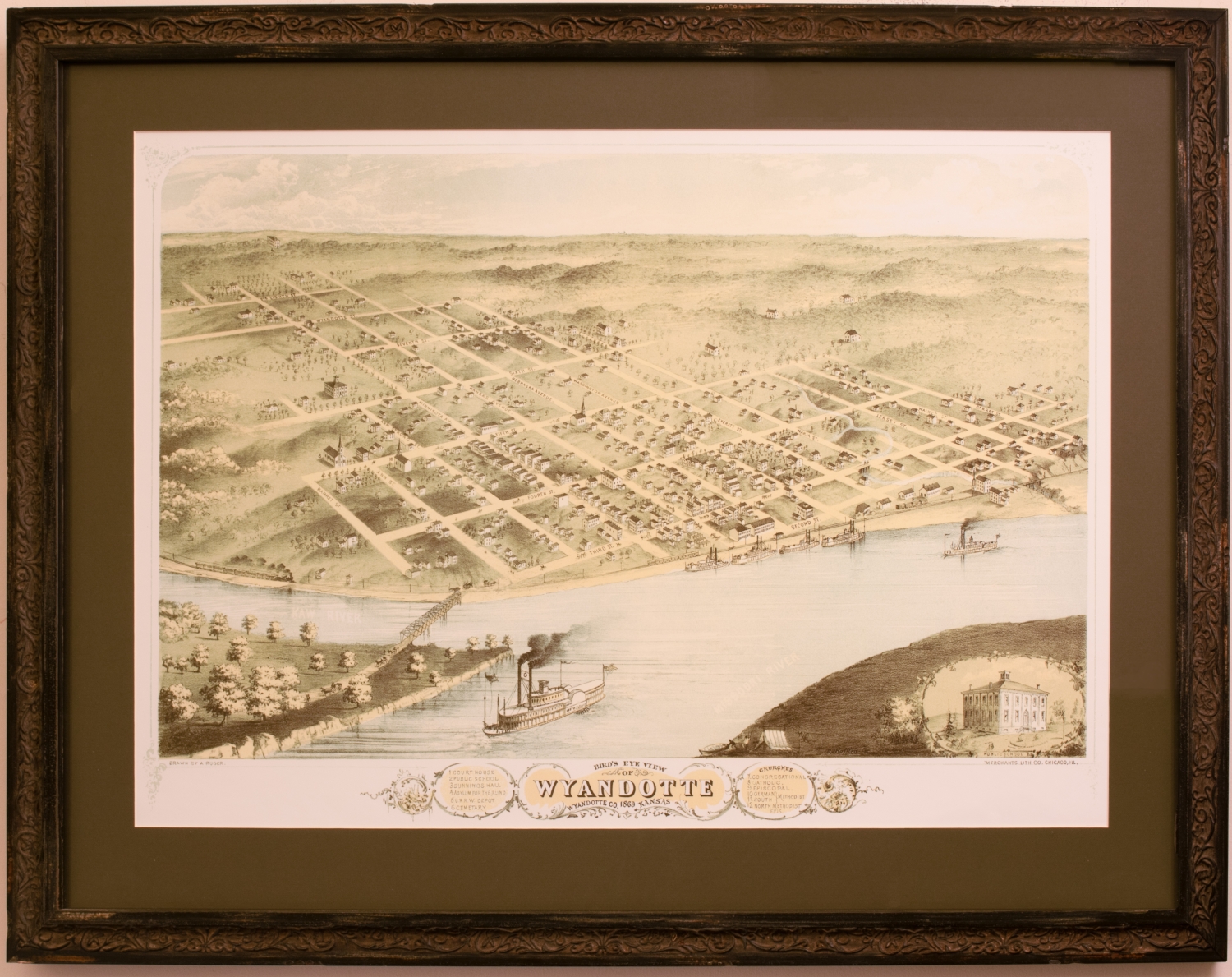
This map features a growing section of Wyandotte County in Kansas in 1869. Above the crux of the Kaw and Missouri Rivers lies the beginnings of a grid development across the land beyond. Amongst the dwellings, significant buildings are numbered and referred to in the ornate legend at the bottom of the map. Listed from 1-10 are the Court House, Public School, Dunnings Hall, Asylum for the Blind, U.R.R. W. Depot, Cemetary, and then the Congregational, Catholic, Episcopal, German and South Methodist, and North Methodist Episcopal churches. Named streets hatch through the land and fade off into the distance, signifying the possibility for future development. Barges can be seen docking on the river below and a train, too, can be seen approaching from the left. Starting in the late 19th century, "Bird's eye" was a popular point of view to render cities despite air travel not being possible yet. Because of this, maps drawn from above were considered a novelty and high cartographic craft, especially considering the imagination in tune with devotion to detail required to create the scene.