Support the Kansas City Public Library on #LibraryGivingDay.
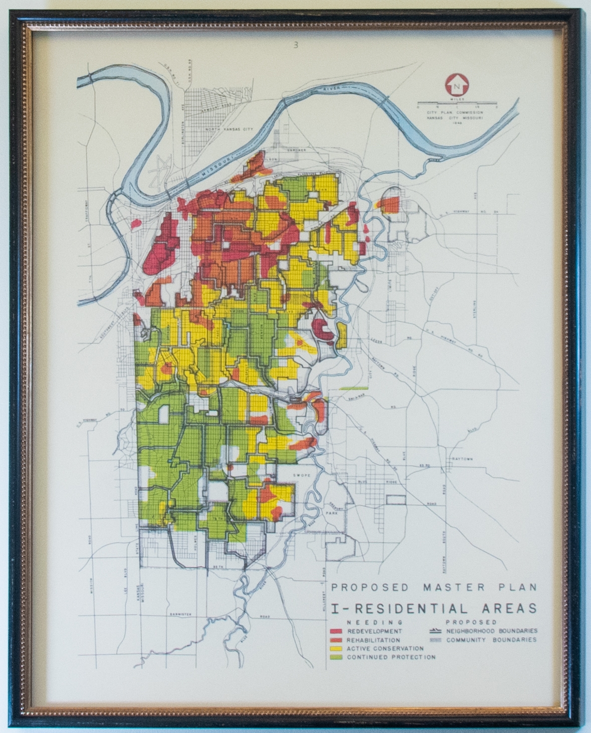
1946 City Plan Commission Map of Residential Areas
This is the first proposed master plan for residential areas in Kansas City generated in 1946. The gridded map indicates needed redevelopment, rehabilitation, conservation, and protection along with proposed neighborhood and community boundaries. Each element is color or pattern coordinated and corresponds to a legend in the lower right-hand corner of the map.