Support the Kansas City Public Library on #LibraryGivingDay.
1946 City Plan Commission Map of Public Schools
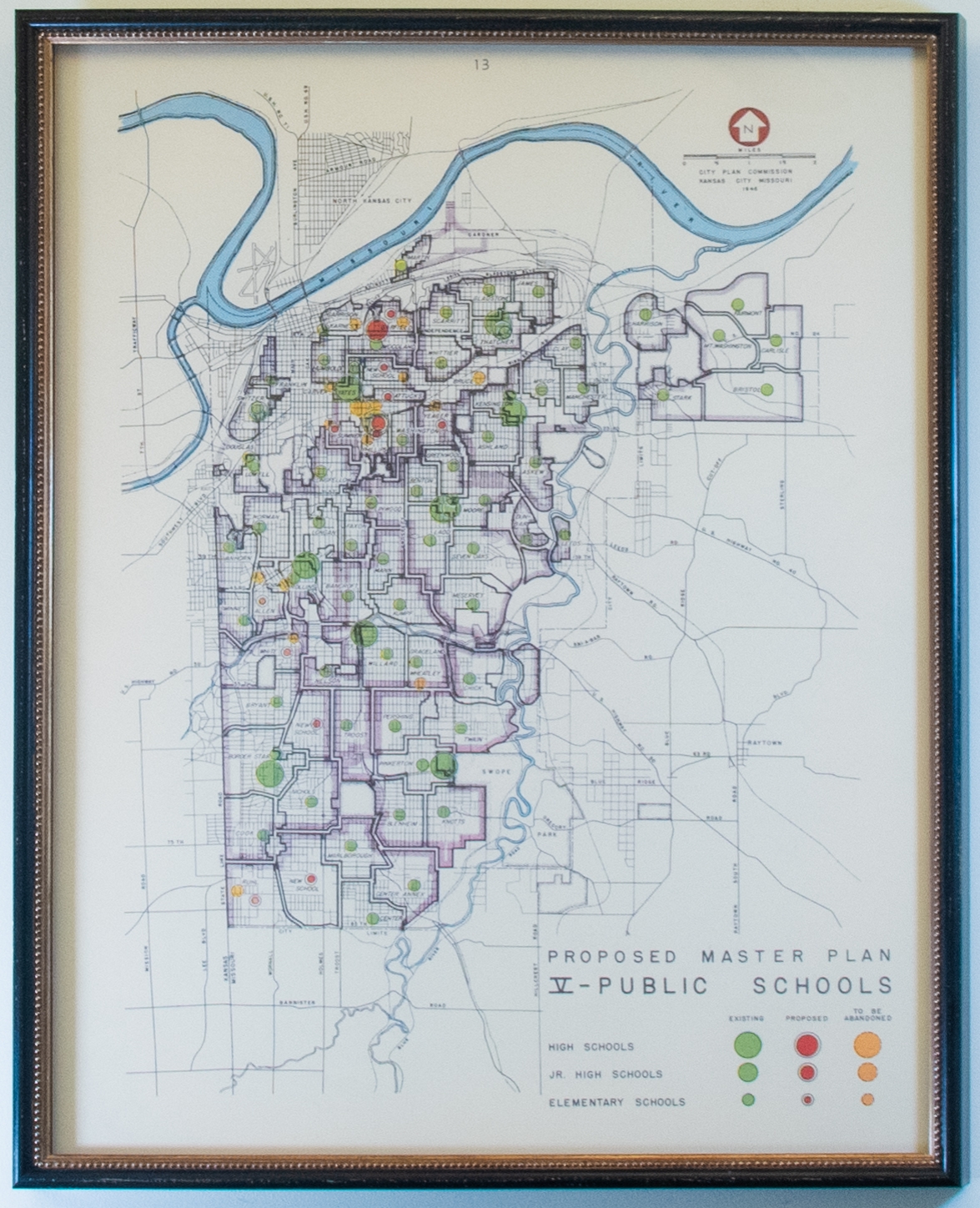
This is the fifth proposed master plan for public schools in Kansas City generated in 1946. The gridded map indicates elementary, junior high, and high schools on the map by circles sized small, medium, and large respectively. The map differentiates the location of existing schools in green as well the "proposed" in red and "to be abandoned" in yellow, as illustrated by the legend in the lower right-hand corner. The legend does not mention neighborhood districts but each is delineated and named on the map itself.