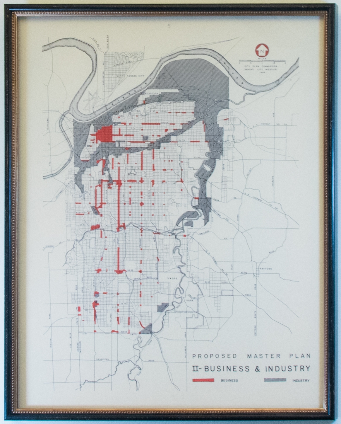
1946 City Plan Commission Map of Business and Industry

This is the second proposed master plan for business and industry areas in Kansas City generated in 1946. The gridded map indicates business in red and industry in gray areas on the map that correspond to a key in the lower right-hand corner.
Inventory
Collection Number
17262
Building
Current Location
Elevator Area
Floor
5th
Description
Details
This is a reproduction print of a Kansas City Planning Commission map of business and industry in 1946.
Framed
Yes
 - Plexi
Width
1 1/4 inches
Height
27 5/6 inches
Length
10 1/8 inches
Donor
Library Owns
No
Permissions
Reproduce the Work in Library publications/publicity, including film or videotape
Yes
Reproduce
Library has Photography Rights
Yes
Photograph
Permit the general public to photograph the work
Yes
Slides/Video