1837 Map of Western and Northern Frontier
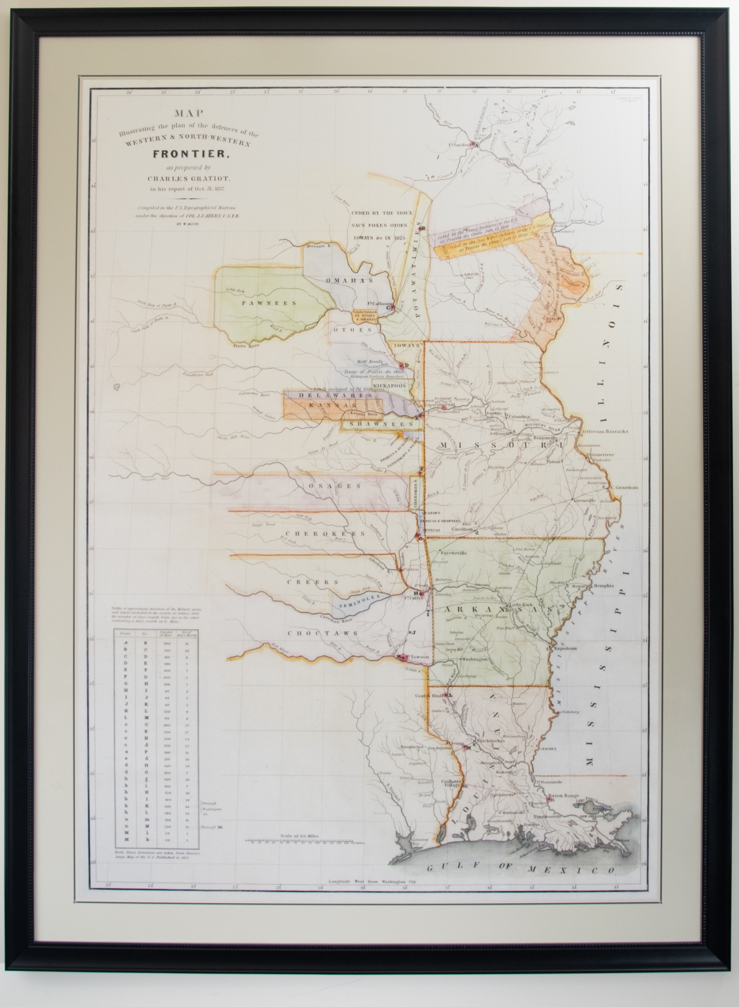
As stated on the upper left hand corner of the map, this map illustrates "the plan of the defences of the Western and North-Western Frontier, as proposed by Charles Gratiot, in his report of Oct. 31, 1837." The Frontier is at the western edge of the central Midwestern states: Iowa, Missouri, Arkansas, and Louisiana. The Frontier is further defined by the regions inhabited by various Native American tribes who encountered the US military. Colonel Charles Gratiot compiled this information under the direction for the US Topographical Bureau under the direction of the head of the United States Corps of Topographical Engineers at that time, Colonel. J.J. Albert. As labeled cities and states dwindle to sole river names and Native American tribe regions, one gets an idea for the unfamiliarity of the land yet untouched past the Frontier.